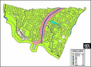
Municipal GIS
Land information is crucial for planning and development. The rapid pace of development in many of the Municipalities in India.

- While bringing high growth rates also brings with it heavy burdens on land utilization.
- To ensure that the high growth rates can be sustained, it is imperative to plan for an effective Land Information system to plan the utilization of its land resources for development while at the same time protect the environment.
- The department can minimize vexatious boundary disputes and consequently civil litigation can efficiently safeguard the survey framework on ground.
- Since the numeric data of each Survey Field is computerized, the maps generated by the computer area, without exception, for more accurate than the maps available at present and can function as efficient decision making tool.


